Museum / Rooms / Africa in precolonial period
Room · 7 chapters · 74 lives
Africa in precolonial period
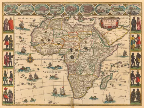
Enormous natural wealth of “Black Continent” attracted explorers and conquerors since ancient times to this day
Land of the Pharaohs – the oldest civilization of Africa
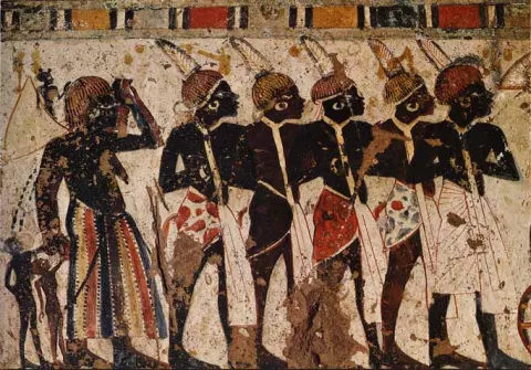
The civilization of ancient Egypt that developed 5000 years ago in North Africa was one of the wealthiest economies of ancient world. Many other powers in the coming times, such as the Phoenicians, Romans, Arabs, Ottomans and others had an economic foothold in North Africa.
Ghana or Wagadu Empire
The sub-Saharan region is known as one of the wealthiest gold production areas on the continent. The caravans of Berbers and Arabs have undertaken the exhausting journeys across the Sahara to reach the Ghana Empire that Arabs called “The Land of Gold”. This extremely wealthy realm dominated gold trade between the 7th and 13th centuries exchanging this metal for salt and weapons. Interestingly, salt in Africa was worth as gold and its merchants class Wangara earned a fortune trading salt further through the West Africa.
Kingdom of Mali
Mali was another prosperous trading empire of West Africa that flourished between the 13th to the 16th centuries. Its main international port was Timbuktu placed on the edge of Sahara. In addition to gold the Berbers and Arabs also highly valued the kola nut, a mild narcotic obtained from the region’s forests whose usage was a part of the etiquette of everyday hospitality in the Muslim world.
Kanem and Bornu Empires
Since the Kanem and Bornu Empires on the area around Lake Chad lacked gold to trade they became a main suppliers of slaves from the West African savanna to the Islamic world from the 9th to the 19th centuries. Slaves were commonly traded for horses to facilitate conducting of business. A good horse was worth between 10 and 30 slaves.
Kush Kingdom
Kush Kingdom formed south of the Egyptian Empire in an area historically known as Nubia was an important element of the ancient trading network that extended from the Mediterranean Sea to the Indian Ocean. It channeled iron products and commodities such as ivory, gold, ebony, and slaves from Central and East Africa to the Roman Empire, Arabia and India.
Axum
Axum located in present day Ethiopia and Eritrea thrived for centuries due to its strategic position on the commercial trade route between India and the Mediterranean. Its major export commodities were ivory, frankincense, myrrh, and slaves which its merchants exchanged for textiles, metal goods, wine, and olive oil.
The African continent was named after a small Berber tribe Afri which lived in the region of modern Tunisia.
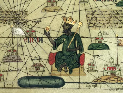
Modern estimates suggest that the 14th century ruler of Mali, Mansa Mūsā was the richest man the world has ever seen, richer even than today’s billionaires.
It has been estimated that as much as two-thirds of Europe’s requirements of gold came by camel caravans crossing the Sahara desert. Gold was in a high demand by Europeans as it was used by governments and Church, for production of coins and jewelry, and to fund lucrative trade with the East.
Trade network along the East African coast and across the Indian Ocean, facilitated by the monsoon winds, with time became one of the most lucrative sources of commercial profit in the ancient and medieval worlds.
Axum was founded most likely by migrants from the Kingdom of Saba (Sheba), situated across the Red Sea on the southern tip of the Arabian Peninsula whose wealthy queen “the Queen of Sheba” is mentioned in Bible.
Land of Zanj
Called by the Greeks “Azania” and by the Arabs “Land of Zanj”, the East African coast was a wealthy and important part of the route which connected Mediterranean world with the Indian Ocean. Its settlements, of which the most important for India trade was Kilwa, were founded by people from the Arabian Peninsula and Persian Gulf during the 7th and 8th century. Merchants in these centers amassed a large fortune as could be seen by their palaces made from coral stones.
South Africa
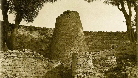
The most powerful and prosperous kingdom in the South Africa between the 12th and mid-15th centuries was Zimbabwe. It was an area wealthy in gold and their mines could provide as much as a ton of gold in a year.
By the 12th and 13th centuries, a mixed-African-Arabian culture emerged at east African area, known as Swahili (from the Arabic sahel, meaning coast).
Until the end of the 19th century European activity in Africa had been confined mainly to small, isolated enclaves on the coast, used for trading purposes. Afterwards began scramble of European powers for African territory. By the end of this process, European powers had merged around 10,000 African polities in just 40 colonies causing many troubles that are visible on the continent to this day.
Chapters
- History of the African continent
- North Africa
- Western Africa
- Central Africa
- Eastern Africa
- Land of Zanj
- South Africa
History of the African continent
African continent is considered the cradle of humankind. The second largest continent of the world, Africa has enormous wealth in natural resources and biological diversity that attracted explorers and conquerors since ancient times. The Black Continent is also a place with rich historical heritage where different cultures and influences intermingled for centuries.
The first great civilization of Africa developed around 5000 years ago in the northeast, on the fertile area around the River Nile. The Ancient Egypt represented the link between interior Africa, civilizations around the Mediterranean basin, and the lands of the Indian Ocean for centuries. North Africa was in general a commercially busy area and the scene of notable people such as the Phoenicians, Berbers, Romans, Arabs and the Ottomans.
During the 1st millennium BC, other areas of the continent began to get on importance. In West Africa, the link between interior African trading states and Mediterranean was established across the Sahara. Lucrative trans-Saharan trade enabled rise of the extremely wealthy and surprisingly sophisticated empires such as Ghana and Mali Empires in Western Africa. While West African empires traded mostly in gold, the empires of central Africa around Lake Chad which lacked attractive goods profited from the trans-Saharan trade by trading mostly in slaves. In the region of the upper Nile River, the states of Kush and Axum established control over trade for several centuries. And on the eastern African coast, from the Horn of Africa to the straits between the continent and Madagascar, native population became involved in the commercial traffic in the Indian Ocean.
After the discovery of the maritime route to India in the 15th century and development of American colonies, history of the African continent has entered a new epoch. However, until the end of the 19th century European activity in Africa had been confined mainly to small, isolated enclaves on the coast, used for trading purposes. Afterwards began scramble of European powers for African territory. By the end of this process, European powers had merged around 10,000 African polities in just 40 colonies causing many troubles that are visible on the continent to this day.
North Africa
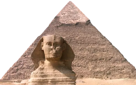
The civilization of ancient Egypt that developed 5000 years ago was one of the wealthiest economies of ancient world. Ruled by the mighty pharaohs and their loyal bureaucratic apparatus, the ancient Egypt achieved the level of wealth and prosperity by which is known to this day. Vast agricultural surpluses were replenished by commercial profits obtained through access to important trade routes of antiquity. During the New Kingdom (16th-11th century BC), Egypt became an imperial power. Through military engagement, diplomacy and trade networks, the Egyptian empire stretched to 2 thousand miles – from the Euphrates in Syria to new boundaries on the Upper Nile in Nubia. Although in the 1st century BC Egypt lost its independency by becoming a Roman province, it continued to flourish in the following centuries.
The North African coast was inhabited by indigenous Berber population from the ancient times.
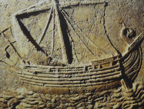
The Phoenicians known as the famous sailors and traders of antiquity settled North African coast around 10th century BC with Carthage as the leading city-state. With the base in North Africa the Phoenicians devloped one of the largest navies in the Mediterranean and fostered industrial, agricultural and commercial activities. Using favorable position, the Phoenicians established a large commercial network in the Western Mediterranean and sent trade expeditions as far as the Atlantic and trans-Saharan area.
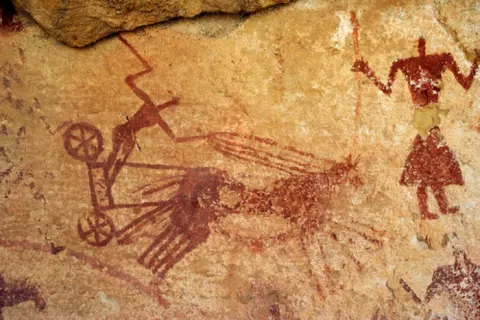
The Berbers, a pastoral people of North Africa acted as intermediaries in the trans-Saharan trade netween the African interiror and northern Africa. They carried food products and manufactured goods from Carthage across the Sahara, and exchanged them for salt, gold, copper, skins, various agricultural products and possibly slaves.
There were two main routes across the Sahara. The first ran southwards, starting from the Lixus (Larache in Morocco) towards the goldfields of Bambuk, in the Senegal River valley. The second ran from Tripolitania (today’s western Libya) to the oases of the Fezzan.
There, in the oases of the Fezzan the Garamantes people established a prosperous kingdom that lasted for over a thousand years. It relied on slave labor and mining of fossil water necessary to support life. The Garamantes transported commodities between societies along Mediterranean Sea and sub-Saharan Africa – carrying salt, glass, metal, olive oil, and wine to Central Africa in return for gold, slaves and various tropical products.
In the mid-2nd century BC the Phoenicians lost their supremacy over the Mediterranean over the Romans who were the new power in rise. The North Africa has been renamed the Roman Provincia Africa. This name which was taken from a small Berber tribe Afri, later came in use as a designation of the whole continent.
The Roman rule which stretched from Egypt on the east to Morocco on the west, brought the economic prosperity to the region. Interested in continuous flow of agricultural supplies for its large population, the Roman government fostered agricultural production and development on that area. The grain was the main object of interest. By the 1st century, Africa provided the bulk of Rome’s total requirements, that is, more than 60 percent. Egypt, known as “Rome’s granary” provided 100,000 tons of corn a year, while other territories of northern Africa around 200,000 tons a year. The second valuable industry represented the olive production. The olive groves were planted in the southern Tunisia and southern Numidia, as far west as the Aures Mountains. Olive was widely used not only in cooking, but also for production of soaps and perfumes and as a fuel for lightening. Using Egypt as a base, the Romans developed trading relations with the Kingdom of Kush, south of Egypt, and with the Red Sea ports and northern regions of the Indian Ocean.
After the Roman rule began to fade starting from the end of the 3rd century, the Vandals stepped on the African soil and established a kingdom in North Africa for a hundred years. The Byzantine emperor Justinian put an end to their power in the 6th century and annexed the territory to the Byzantine Empire.
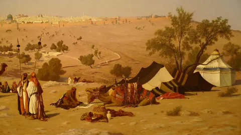
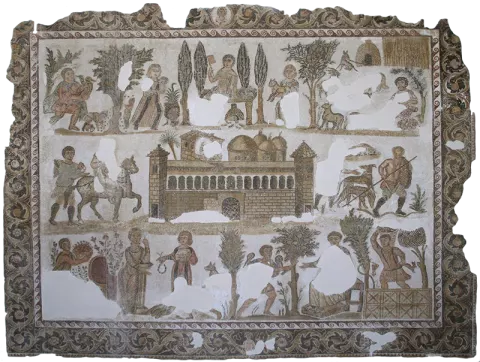
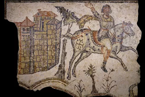
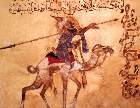
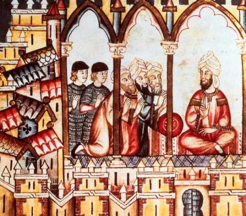
However, in the 7th century, the new political and religious force established control over North Africa, now called “Ifriqiya”, setting up footholds in West and East Africa as well – the Arabs. It is the way the Islam spread. Their rule marked the beginning of reintegration of the sub-Saharan Africa into the broader historical development. From their base in the North Africa, Muslim merchants began to develop trade routes across the Sahara to reach commercial centres of “Bilad As-Sudan”, or the “Land of the Blacks”. The arrival of resilient camels from the Middle East expanded this trade dramatically. The first merchants to organize regular camel caravans across the Western Sahara were Ibadi merchants from southern Morocco and Wargla merchants in southern Algeria. By the 12th century, caravans as large as 12,000 camels were crossing the desert.
A 13th-century Arab manuscript of a Muslim warrior on a camel.
Western Africa
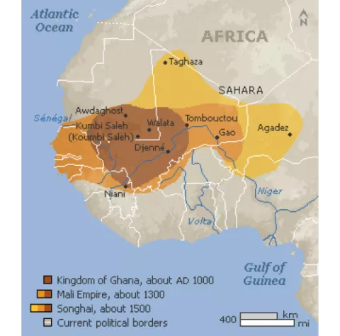
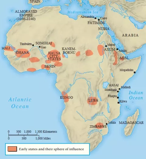
The first sub-Saharan empire which successfully established control of the southern end of the Saharan trade was Ghana or Wagadu Empire, which flourished between the 7th and 13th centuries. The Arab people called it “The Land of Gold”. Situated between Sahara and the headwaters of the Senegal and Niger Rivers, on its territory was one of the richest gold producing areas in all of Africa. Except gold, their merchant class called Wangara exported ivory, ostrich feathers, hides, leather goods, and slaves. The most important merchandise coming from the north was salt. The Wangara merchants earned a fortune trading this commodity through West Africa as its price could increase hundredfold. They imported metal goods, particularly weapons, textiles and horses in addition to salt.
As the rule of Ghana declined in the 11th century, the Muslim Almoravids emerged and eventually seized control of both ends of the trans-Saharan trade. At its height, in the early 12th century, the Almoravid Empire encompassed Morocco, Mauritania, western Algeria and southern half of Spain. But their rule was eventually challenged by another Berbers, the Almohads. Their empire extended even further than the Almoravids, covering all of the Maghreb as far east as Tripolitania, as well as Muslim Spain. But, in the 13th century, Almohad rule collapsed too.
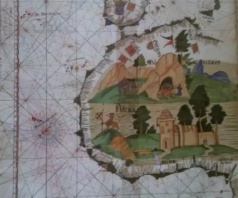
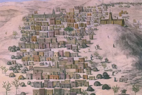
Following the fall of Wagadu Empire on the south end, the new empire took control of the gold trade. It was the Kingdom of Mali. They controlled not only the goldfields of Bambuk and Bure, but also the gold trade routes from Akan lands of the Volta region far to the south. Timbuktu was the main port on the edge of Sahara where international trade was conducted. Except of gold, the kola nut from the forests of West Africa was very prized in the Muslim world. When chewed, it provided a mild narcotic and formed part of the etiquette of everyday hospitality. Their rulers owned one of the greatest riches in history. Mansa Mūsā, the 9th king of Mali, is best remembered in the Middle East and Europe for the splendor of his pilgrimage to Mecca (1324). His picture decorates the Catalan Atlas of 1375, one of the first sets of European maps to provide valid information about Africa. Note on the map said: “So abundant is the gold which is found in his country that he is the richest and most notable king in all the land”. The powerful Mali Empire disintegrated by the 16th century.
Central Africa
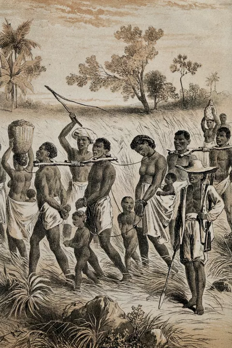
While slave trade made only a minor part of the Western trans-Saharan trade, in the central Sahara it consisted the mainstay of trade. Kanem and Bornu trading empires ruled by the Sayf dynasty controlled the area around Lake Chad, from 9th-19th century. Since they had no gold to trade, their main commodity represented slaves. They were the main suppliers of slaves from the West African savanna to the Islamic world, buying in return horses to facilitate their business. Slaves were marched across the desert to Zawila, a trading base in the Fezzan and from there sent on to Tunis, Tripoli, Cyrenaica, Egypt and beyond to western Asia.
Eastern Africa
An important part of the ancient trading network that extended from the Mediterranean Sea to the Indian Ocean comprised Kush and Axum kingdoms. Kush was formed south of Egypt, in an area historically known as Nubia. It evolved into a major trading power in Africa. It was a supplier of iron products, as well as of goods from Central and East Africa, notably ivory, gold, ebony, and slaves, to the Roman Empire, Arabia and India. The goods were transported partly by land, using donkey and later camel caravans, and partly by river. Kush was later conquered by Axum, a new power located in the present day Ethiopia and Eritrea, which became dominant in the trade through Red Sea.
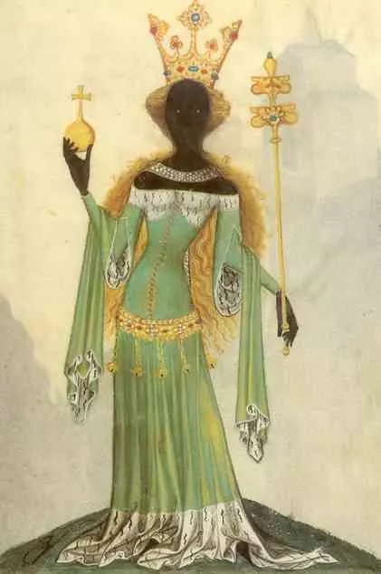
Axum was founded most likely by migrants from the Kingdom of Saba (Sheba), situated across the Red Sea on the southern tip of the Arabian Peninsula. The kingdom is even mentioned in Bible, and “Queen of Sheba” is credited with vast wealth and resources. The wealth derived from trade. During antiquity, Saba was a major trading state and transit point for goods carried from South Asia into the lands of Mediterranean. After the importance of Saba declined due to desiccation, Axum continued to thrive for centuries. It was due to its strategic position on the commercial trade route between India and the Mediterranean. Axum exported ivory, frankincense, myrrh, and slaves. Its primary imports were textiles, metal goods, wine and olive oil. By the end of the 6th century, the kingdom of Axum was in a state of decline.
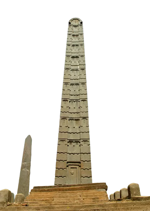
The main Obelisk of Axum is supposedly 1,700 years old, 24 meters tall (79-foot), and weighs 160 tonnes.
Land of Zanj
Trade network along the East African coast and across the Indian Ocean, facilitated by the monsoon winds, with time became one of the most lucrative sources of commercial profit in the ancient and medieval worlds. The East African coast was an integral part of that route. The Greeks had called it Azania, and the Arabs called it Land of Zanj. In the course of the 7th and 8th century, people from the Arabian Peninsula and the Persian Gulf, started to make settlements at ports along the coast and on small islands. Eventually, these settlements evolved into important commercial centers, such as Mombasa, Pemba, Zanzibar and Kilwa. Kilwa held especially important role, especially as a port for ships hoping to complete the round-trip journey in a single season. In the 14th century, the Muslim traveller Ibn Batuta finds Kilwa an extremely prosperous sultanate, busy with trade in gold and slaves.
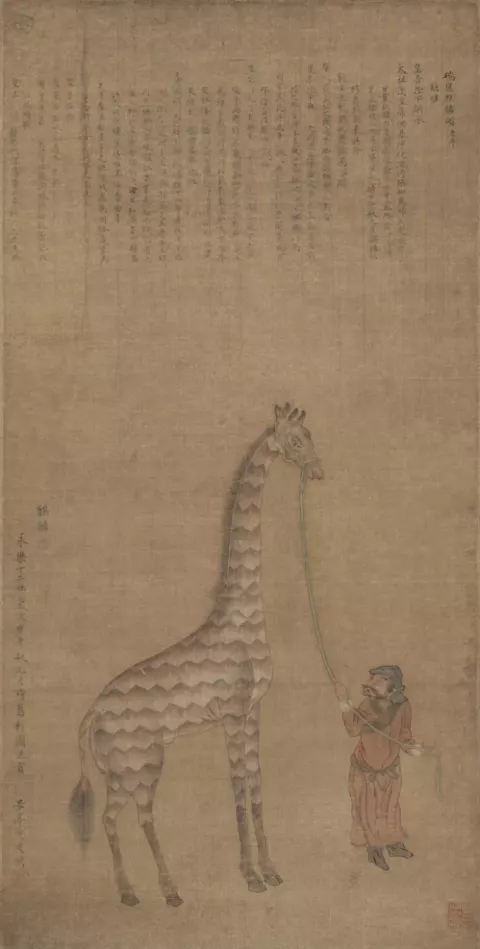
Goods such as ivory, rhinoceros horn, leopard skins, and gold were exported across the Indian Ocean as far away as China, while imports included iron goods, glassware, Indian textiles and Chinese porcelain. Merchants in these centers amassed a large fortune, as evidenced by their palaces made from coral stones. During the period of Chinese exploration headed by the Zheng He, official relationships were established between East Africa and China. Envoys of Malindi even visited the Chinese emperor and gave him a giraffe on that occasion.
By the 12th and 13th centuries, a mixed-African-Arabian culture emerged at that area, known as Swahili (from the Arabic sahel, meaning coast).
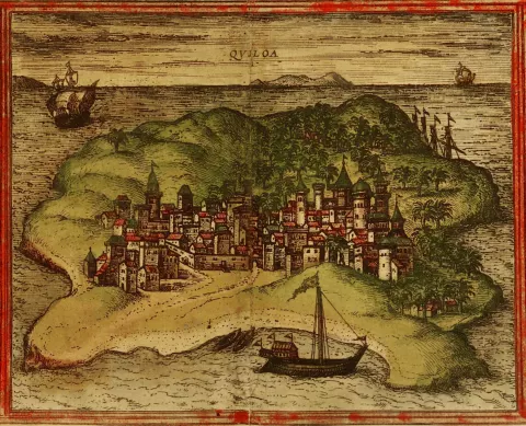
A 1572 depiction of the city of Kilwa from Georg Braun and Frans Hogenberg's atlas Civitates orbis terrarum.
South Africa
In the southern half of the African continent, from the great basin of the Congo River to the Cape of Good Hope, kingdoms formed somewhat more slowly than in the north. In the Congo River Valley, natural conditions enabled agricultural activities and manufacturing sector thanks to deposits of copper and iron. The Kingdom of Luba, founded in the 14th century in the central Africa near the shores of Lake Kisale, and the Kingdom of Kongo, situated south of the Congo River on the Atlantic Coast, took an active part in exchange of goods throughout the region.
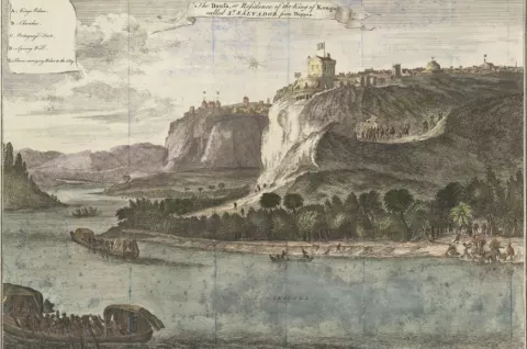
View of the city M'banza-Kongo, capital of the kingdom of Congo, now Angola, engraving from Description of Africa, by Olfert Dapper (ca 1635-1689), Amsterdam, 1686
Farther to the east, Zimbabwe state evolved on the plateau of the same name between the Zambezi and Limpopo Rivers. It was the most powerful and prosperous state in the region between 12th and mid-15th century. The Kingdom played a major role in the gold trade with Swahili trading communities on the eastern coast. Their mines could provide as much as a ton of gold in a year. Its capital, Great Zimbabwe (Zimbabwe means “sacred house” in the Bantu language), was situated between gold reserves and a small river leading to the coast and was able to benefit from trade between the coast and interior.
74 lives in this room
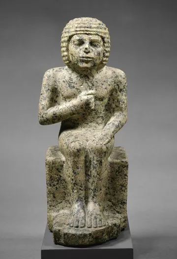 Metjenc. 27-26 century BC
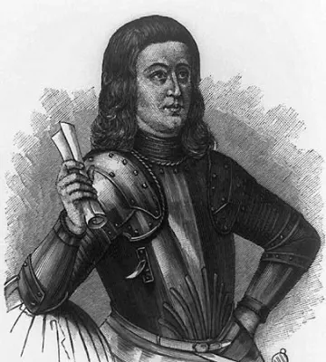 Martin Behaim1459-1507
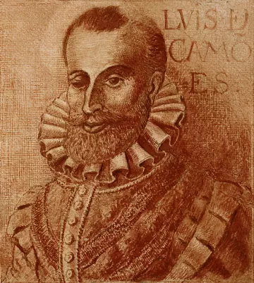 Fernão Gomesfl. 1469-1486
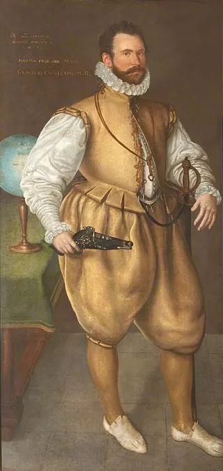 Sir Martin Frobisherc. 1535-1594
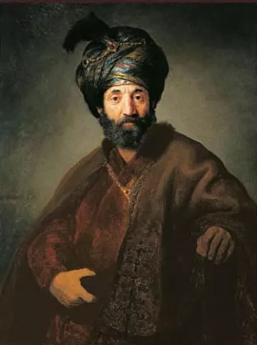 Samuel Pallachec. 1550-1616
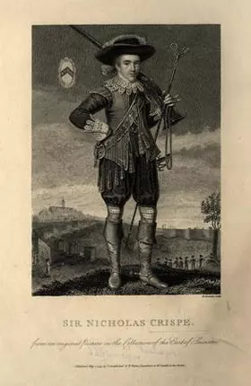 Sir Nicholas Crispec. 1599-1666
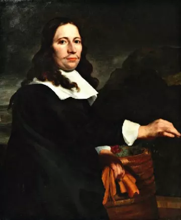 Simon van der Stel1639-1712
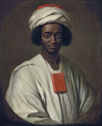 Ayuba Suleiman Diallo1701-1773
More lives in this room
- Sekhem-Ka c. 30th century BC
- Ti c. 25th century BC
- Hekanakhte c. 20th century BC
- Montuwosre c. 20th century BC
- Senebtysy c. 18th century BC
- Pabes c. 13th century BC
- Mibtahiah of Elephantine 476-412 BC
- Gaius Peticius 1st century BC
- Marcus Julius Alexander 1st century
- Nicanor 1st century
- Aelia Isidora 2nd century
- Aelia Olympias 2nd century
- Julia Crispina of Egypt and Judea 2nd century
- Cosmas Indicopleustes 6th century
- Constantine the African c. 1010 – c. 1087
- Judah ben Joseph of Kairouan late 10th – early 11th century
- Nahrai ben Nissim 11th century
- Sahlān ben Abraham 1050
- Wuhsha of Egypt 11th–12th century
- Abu al-Majd ibn Abi Ghalib ibn Sawirus 12th-13th century
- Abu'l Abbas al-Hijazi 12th century
- Ḥalfon ben Nethanel Ha-Levi Abu Saīʿd 12th century
- Ibn Bikash 13th century
- Nūr al-Dīn ʿAlī b. ʿUthmān 13th century
- Majd al-Din Isma‘il ibn Muhammad ibn Yaqut al-Sallami 1272-1342
- Kamāl al-Dīn 14th – 15th century
- Zakī al-Dīn Abū Bakr 14th century
- Badr al-Dīn Muḥammad b. Muḥammad died 1361
- Ṣalāḥ al-Dīn Aḥmad b. Muḥammad died 1368
- Nāṣir al-Dīn Muḥammad Ibn Musallam died 1374
- Fakhr al-Din ‘Uthman ibn Muhammad ibn Ayyub ibn Musafir al-As‘ardi died 1381
- Nūr al-Dīn ʿAlī al-Kharrūbī died 1400
- Burhan al-Din Ibrahim al-Mahalli died 1403
- Antoniotto Usodimare 1416 – 1461
- Sirāj al-Dīn ʿUmar b. ʿAbd al-ʿAzīz died 1422
- Alvise Cadamosto 1432-1488
- Nathan HaKohen Sholal 1437–1502
- Antonio Malfante died 1450
- Eustache de la Fosse c 1451-1523
- Fakhr al-Dīn Sulaymān al-Kharrūbī died 1460
- Isaac Sholal d. 1524
- Abraham Benwaish 16th–17th centuries
- Ismail Abu Taqiyya 16th-17th century
- Jacob Rosales late 15th – early 16th century
- Samuel Cabessa 16th century
- Solomon Alashkar 16th century
- John Rashleigh II 1554 – 1624
- Hananiah Sebag d. after 1570
- Thomas Banister died 1571
- William Towerson died 1584
- Khoja Murad c. 1618- c. 1700
- Benjamin Levy c. 1650-1704
- Pieter Woortman 1700-1780
- Ḥayyim Toledano Ben Baruch d. c. 1715
- David Franks 1720–1794
- Jan Pieter Theodoor Huydecoper 1728-1767
- Judah Levy-Yuly d. after 1737
- Daniel Toledano d. c. 1740
- R. Samuel Levy Abenyuly d. after 1740
- Judah Aben-Yuly 1750
- Jacob Coen Bacri 1763–1836
- Shalom Delmar-Lebhar d. after 1775
- Mordecai Baruch Carvalho d. 1785
- Antera Duke died c 1788
- Cornelius Ludewich Bartels d. 1804
- Minnakhte 2nd millenium BC